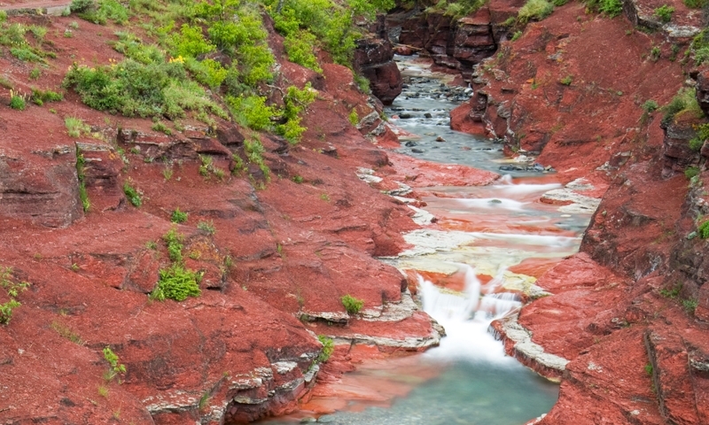
- Red Rock Canyon offers exquisite views featuring red and green bedrock, alpine vegetation, and protruding peaks.
- Located 10 miles northwest of Townsite, at the end of Red Rock Parkway.
- Explore the canyon from early May until late October.
- Red Rock Canyon is a popular scenic destination with plentiful hiking trails.
Overview
Red Rock Canyon is a breathtaking natural treasure awaiting travelers at the end of Red Rock Parkway. Created due to water erosion, this canyon delights visitors with an array of red and green colored bedrock, called argillite, further accented by the surrounding lush vegetation, wildflowers, and mountain peaks in the background. An excellent place for photos, picnic lunches, and trail access leading into the wilderness, a trip to Waterton Park is incomplete without a moment spent at the canyon.
Location/Directions
Red Rock Canyon is located at the end of Red Rock Parkway, 10 miles northwest from Waterton Townsite.
Season
Red Rock Canyon can be seen and explored from early May until October 31, when Red Rock Parkway is open to visitor traffic.
Activities
Photography/Sight-Seeing: Snap a photograph, capturing the dramatic beauty of this area, including wildlife, vegetation, rock outcroppings, and wildflowers in summer.
Hiking: Red Rock Canyon offers trail access into the northwestern region of Waterton Park. Try one of the following hikes:
Red Rock Canyon Trail
- Trailhead: Red Rock Canyon
- Distance: .7 kms (.5 miles)
- Total Time: 20 minutes
- Ascent: Minimal
Blakiston Falls Trail
- Trailhead: Red Rock Canyon
- Distance: 2 km (1.2 miles)
- Total Time: 45 minutes
- Ascent: Minimal
Goat Lake Trail
- Trailhead: Red Rock Canyon
- Distance: 12.6 km (7.8 miles)
- Total Time: 5 hours
- Ascent: 400 meters (1312 ft)
- Difficulty: Moderate


